Willamette Valley · Oregon
Parks & Recreation in Corvallis: Trails, Facilities & Outdoor Life (2026)
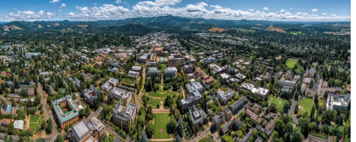
Corvallis manages over 2,000 acres of parks, open spaces, and trail corridors for a city of just over 61,000 people — a per-capita outdoor footprint that rivals cities twice its size. Most newcomers expect a decent park system attached to a university town. What they don't expect is the sheer variety: river walks, oak savanna hilltops, a rose garden with 250+ varieties, and direct trail connections to tens of thousands of acres of OSU research forest.
Geography and Oregon State University have shaped everything here. The Willamette River defines the eastern edge of the city, the Coast Range foothills push in from the west, and OSU's landholdings — including the McDonald-Dunn Research Forest — extend trail access far beyond what city boundaries alone would allow. Corvallis Parks Operations handles the urban infrastructure; OSU and Benton County fill in the wild edges.
This guide covers the parks, trails, and recreation facilities that actually matter to people relocating here — where to go on a Saturday morning, what's genuinely impressive, where the gaps are, and what's within easy reach when you want something bigger than a neighborhood trail.
| Park | Highlights | Best For |
|---|---|---|
| Avery Park & Natural Area | Rose garden, all-inclusive playground, disc golf, Marys River trail, 5 picnic shelters | Families, dog owners, special events |
| Bald Hill Natural Area | 284 acres, oak savanna, 5 miles of trails, views of Mary's Peak | Hikers, wildlife watchers, trail runners |
| Riverfront Commemorative Park | Willamette River frontage, spray fountain, kayak launch, public plazas | Walking, summer festivals, paddle sports |
| Chip Ross Park | 125-acre hilltop, valley views, off-leash dogs, McDonald Forest access | Dog hikers, trail runners, mountain bikers |
| Central Park | Downtown plaza, gazebo, summer concerts, seasonal festivals | Strolling, community events, lunch breaks |
| Peavy Arboretum (OSU) | 40-acre arboretum, 3.9-mile trail, birding, free admission | Birders, casual hikers, nature education |
| Willamette Park | City's largest green space, ~4-mile riverside loop | Long walks, cycling, riverside relaxation |
| Chintimini Park | NW neighborhood park, adjacent to community center | Local recreation, youth programs |
| Bald Hill Farm / Fitton Green | Part of 1,200-acre protected corridor, remote trails | Serious hikers, solitude seekers |
| Garfield Park | Community park, rated among top local spots | Neighborhood families |
| MLK Jr. Park | Named community park | Neighborhood access, casual use |
Location: 1200 SW Avery Park Drive, Corvallis, OR 97333
At 75 acres, Avery Park is the most functionally complete park in the city — part urban green space, part natural riparian area, part community hub. The rose garden alone draws visitors from across the Willamette Valley from May through October, with over 250 varieties at peak bloom in June. A one-mile walking trail runs along the Marys River, five reservable picnic shelters accommodate everything from birthday gatherings to company picnics, and Corvallis's first all-inclusive playground at 1310 SW Avery Park Drive brings adaptive equipment and artificial turf that works for kids with mobility challenges.
Best for: Families with young children, dog owners, rose garden enthusiasts, disc golfers, and anyone hosting an outdoor event.
Location: 6460 NW Oak Creek Drive, Corvallis, OR 97330
This 284-acre natural area west of the city is where Corvallis residents go when they want to feel genuinely outside. The trail system covers approximately five miles across upland prairie, oak savanna, mixed forest, and wetland, with the summit of Bald Hill reaching 755 feet and offering clear-day views stretching to Mary's Peak and across the valley. What most newcomers don't realize is that Bald Hill sits within a much larger 1,200-acre protected corridor that includes Bald Hill Farm, Lupine Meadows, and Fitton Green Natural Area — meaning a single trailhead can open into a half-day of hiking without retracing your steps.
Best for: Trail runners, wildlife watchers, wildflower hikers in spring, anyone wanting a genuine Pacific Northwest landscape within city limits.
Location: NW Lester Avenue (end of street), Corvallis, OR 97330
Chip Ross sits at the far north end of the city and rewards the drive with hilltop views that take in the Willamette Valley, the Coast Range, and on clear days the Cascades. The 125-acre park features a 1.5-mile loop through oak woodland and prairie, a designated off-leash dog area, and — critically — trail connections into OSU's McDonald Forest, where mountain bikers and trail runners can string together many additional miles. It's the park that turns a 30-minute outing into a half-day adventure without leaving the trail system.
Best for: Dog hikers, mountain bikers, trail runners looking for mileage, and anyone wanting panoramic views without a long drive.
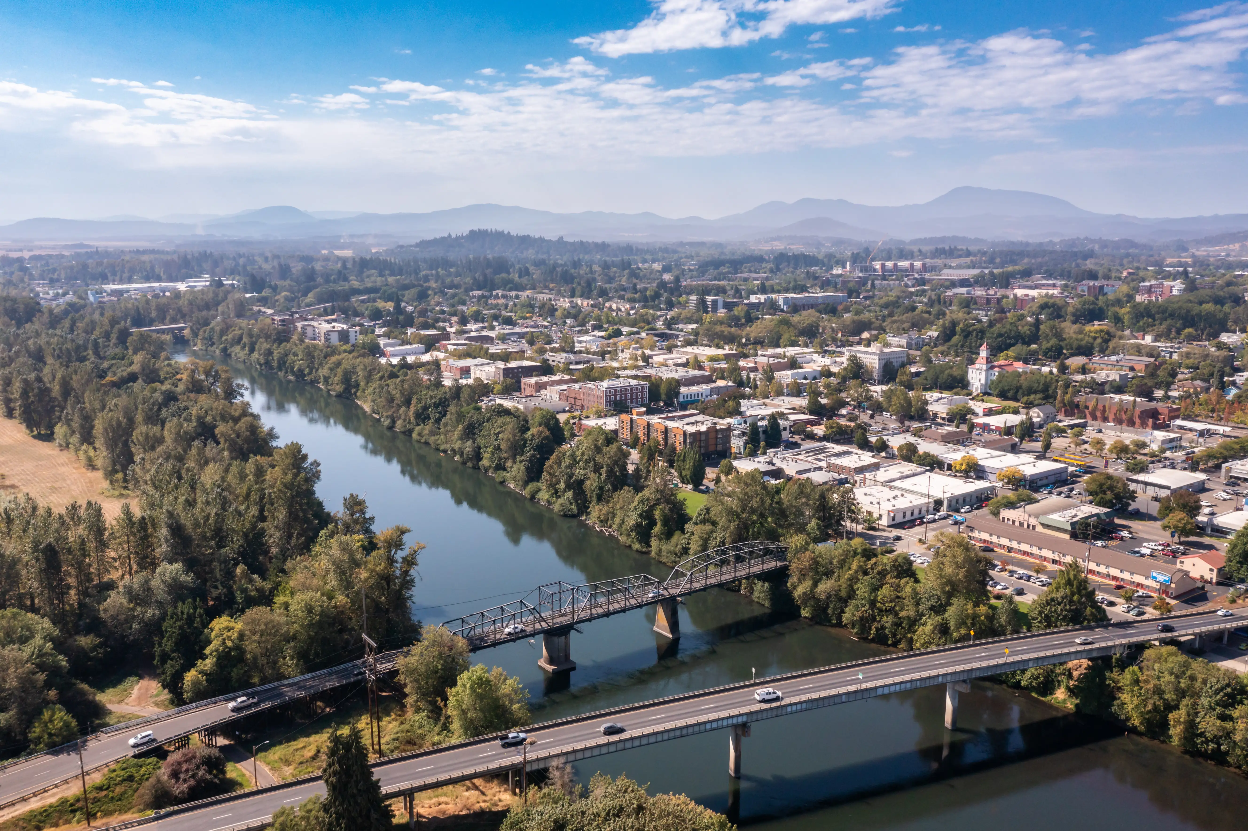
Location: Along First Street, downtown Corvallis waterfront
Nearly 12 acres of Willamette River frontage in the heart of downtown, Riverfront Park anchors the city's outdoor social calendar. The spray fountain opens each May and runs through summer, public plazas host farmers markets and community festivals throughout the year, and the non-motorized watercraft launch is one of the only places in central Corvallis to put a kayak or canoe directly on the Willamette. The park stretches from the Aquathusist boat ramp at the north to Shawala Point at the south, where the Willamette meets the Marys River — a confluence that looks exactly as good as it sounds.
Best for: Paddlers, summer festival-goers, downtown residents who want river access on foot.
Location: 650 NW Monroe Avenue, Corvallis, OR 97330
Three and three-quarter acres sandwiched between Monroe and Madison Avenues in the center of the city, Central Park is Corvallis's downtown common — manicured flowerbeds, paved walkways, a large playground, and a reservable gazebo that doubles as the summer stage for the Corvallis Community Band's free weekday evening concerts. It hosts the annual Fall Festival and Festival of Lights. For a small urban park, it punches far above its acreage in terms of community use.
Best for: Downtown workers and residents, families within walking distance, community event attendees.
The most underappreciated outdoor infrastructure in Corvallis isn't a single park — it's the informal network of connected natural areas along the city's western edge. Starting from Bald Hill Natural Area and extending north through Chip Ross Park to the boundary of OSU's McDonald-Dunn Research Forest, residents can link together well over 15 miles of trail without touching a road, moving through oak savanna, prairie, and second-growth forest. The Willamette River Path adds a complementary urban option, running approximately one mile along First Street and the Riverfront Park waterfront — flat, paved, and accessible from downtown. For commuter cyclists and morning runners who want a car-free route, the combination of the riverfront path and the city's established bike lane network covers most of the urban core effectively.
The Osborn Aquatic Center, operated by Corvallis Parks & Recreation, is the city's primary indoor aquatic facility. It offers lap swimming, recreational swim sessions, water fitness classes, swim lessons for all ages, and competitive programming for youth and adult swimmers. The facility serves both the general public and school-age athletes throughout the year.
The Chintimini Community Center at NW 27th Street and NW Tyler Avenue serves as the hub for indoor recreation programming — fitness classes, youth activities, senior programs, and reservable event space. The Parks & Recreation Administrative Office operates from 501 SW Madison Avenue and can be reached at 541-766-6918 for facility reservations, shelter rentals, and program registration. The city maintains park hours of 6 am to 10 pm daily across all managed properties.

Corvallis is genuinely one of those markets where proximity to parks and trail systems has a measurable effect on how quickly homes move and what buyers are willing to pay. Neighborhoods like Northwest Corvallis and West Hills sit close to both natural trail corridors and community recreation facilities, and well-maintained homes there rarely stay available long — sometimes just days. South Corvallis has also drawn steady interest from buyers who want that outdoor accessibility without stretching too far, and you can still find solid options under $600,000 if you move decisively. The recreational lifestyle here isn't just a quality-of-life factor; it's baked into long-term demand.
That's exactly why I'd encourage anyone seriously considering a move here to connect with a lender before they start touring homes. Knowing your full monthly picture — loan structure, property taxes, insurance, and any HOA dues — gives you a realistic budget to work within, not just a maximum approval number. When a home near a trail or park comes available in a neighborhood you love, you won't have time to scramble. Being financially prepared is what lets you act with confidence.
When Corvallis trails feel familiar, the surrounding region offers substantial options within a short drive.
| Destination | Distance from Corvallis | Highlights |
|---|---|---|
| Mary's Peak (Siuslaw National Forest) | ~25 miles west | Highest point in Coast Range (4,097 ft), wildflower meadows, panoramic views |
| Finley National Wildlife Refuge | ~10 miles south | Wetlands, grasslands, world-class birding, wildlife photography |
| McDonald-Dunn Research Forest (OSU) | Trailhead at city edge | 11,000+ acres, mountain biking, hiking, equestrian trails |
| Alsea Falls Recreation Area | ~35 miles southwest | Waterfall hikes, old-growth forest, swimming holes |
| Marys Peak Meadow Trail | ~25 miles west | Alpine meadow loop, outstanding Cascades views in clear weather |
| Silver Falls State Park | ~90 miles northeast | "Trail of Ten Falls," old-growth forest, year-round hiking |
| Deschutes River State Recreation Area | ~100 miles east | Canyon hiking, fishing, stargazing away from valley cloud cover |
| Willamette Valley Wine Country (cycling) | ~20–40 miles north | Road cycling through Eola-Amity Hills, Chehalem Mountains |
Local Expert Takeaway: The western hills corridor — Bald Hill through Chip Ross and into McDonald Forest — is the outdoor asset that doesn't show up on most buyers' radar until after they've moved here. If you're choosing between two homes at similar price points, proximity to that trail network is worth factoring into your decision. Neighborhoods like Timberhill and Northwest Corvallis that sit closest to those trailheads tend to hold their value specifically because of that access, and it's the kind of amenity that becomes more meaningful the longer you live here.
Is Corvallis a good city for outdoor recreation?
Yes — Corvallis offers an outdoor infrastructure that significantly exceeds what most buyers expect from a mid-size Willamette Valley city. The combination of urban parks like Avery and Central Park, natural areas like Bald Hill and Chip Ross, direct access to OSU's McDonald-Dunn Research Forest, and proximity to Mary's Peak and the Coast Range makes it one of the more trail-rich cities in western Oregon at this population size.
Does Corvallis have good hiking trails within city limits?
Several strong options exist without leaving city boundaries. Bald Hill Natural Area offers roughly five miles of trail through oak savanna and upland prairie with hilltop views. Chip Ross Park adds another 1.5-mile loop with connections into McDonald Forest. The Willamette River Path runs along the downtown waterfront for an easy, paved mile. Most west-side neighborhoods are within a short drive — and some within walking distance — of a genuine trailhead.
How does Corvallis compare to other Oregon college towns for parks and outdoor access?
Corvallis is often ranked alongside Eugene as one of the better-served smaller Oregon cities for outdoor infrastructure. The 2,000-plus acres of managed parkland, the protected western hills corridor, and immediate proximity to Coast Range destinations give it a depth that cities of similar size rarely match. The primary limitation is that the best natural areas cluster on the west and north sides of the city — residents on the south and east sides tend to drive rather than walk to the most significant trail systems.
Explore the full Corvallis series: The Ultimate Corvallis Relocation Guide · Is Corvallis Safe? · Cost of Living in Corvallis · Best Neighborhoods in Corvallis · Corvallis Schools & Family Life · Corvallis Youth Sports · Corvallis Parks & Recreation · Retiring in Corvallis · 1031 Tax-Deferred Exchange in Corvallis · Corvallis First-Time Homebuyers Guide · Corvallis Down Payment Assistance Guide · Moving to Corvallis from California