Willamette Valley · Oregon
Parks & Recreation in Springfield: Trails, Facilities & Outdoor Life (2026)
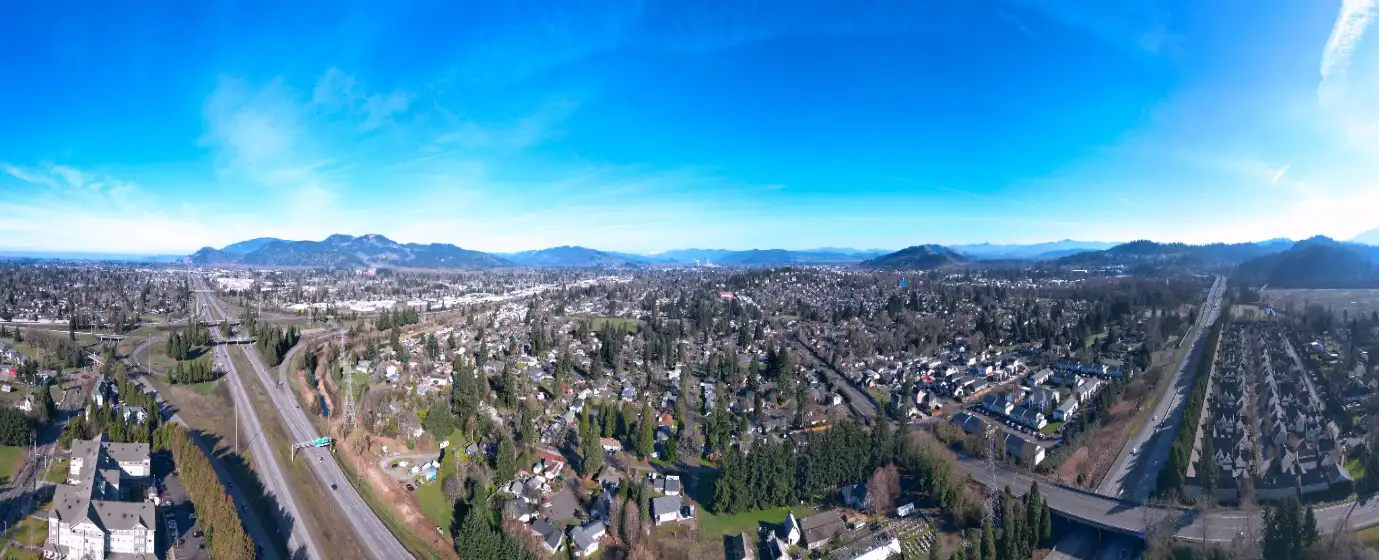
Springfield doesn't look like an outdoor recreation powerhouse from the freeway. What you see driving through is a working-class mid-size city — Franz Bakery, PeaceHealth campuses, industrial corridors along the Willamette. What you don't see from I-105 is that the Willamalane Park and Recreation District manages nearly 1,500 acres across 42 parks and natural areas, operates a CAPRA-accredited system that rivals much larger metros, and anchors the whole thing with an indoor waterpark that actually gets used by locals year-round, not just on field trip days.
The geography here does a lot of the heavy lifting. Springfield sits at the confluence of the McKenzie and Middle Fork Willamette rivers, which means river access, natural corridors, and trail connections that Eugene's denser urban grid can't replicate. Thurston Hills rises at the eastern edge of the city, providing mountain bike and hiking terrain that most Pacific Northwest suburbs would pay considerably more to live near.
This guide covers the parks that matter most, the trails worth knowing by name, the recreation facilities that justify Willamalane's tax district status, and the day trips that turn Springfield's location into a genuine outdoor asset.
| Park | Highlights | Best For |
|---|---|---|
| Thurston Hills Natural Area | 665 acres, 12+ miles of trails, MTB and hiking | Mountain bikers, trail runners |
| Dorris Ranch | 268 acres, historic filbert orchard, 4.5 mi gravel paths, river access | History lovers, casual walkers |
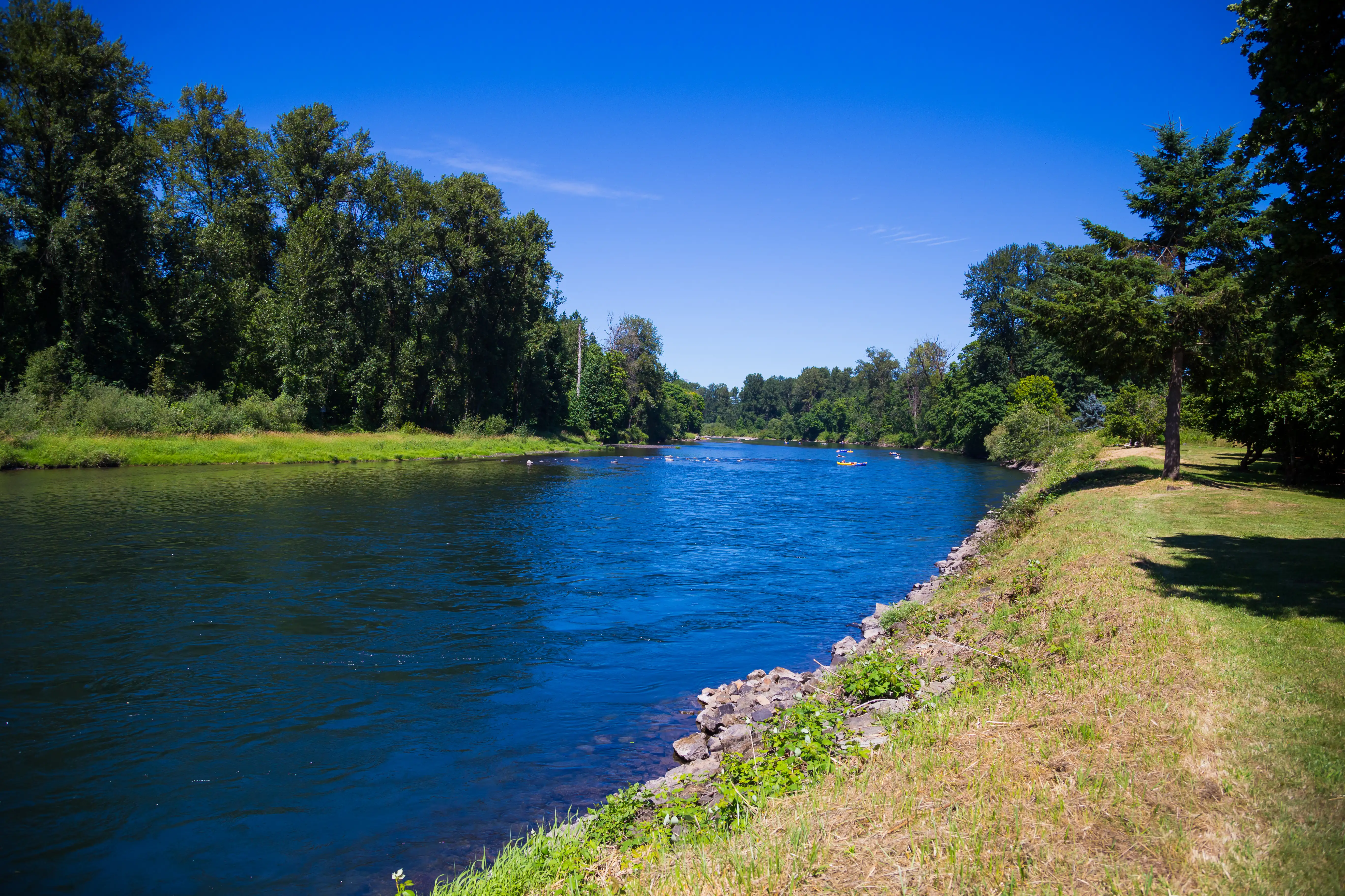
| Clearwater Park | 65 acres, boat landing, fishing, Middle Fork Path trailhead | Kayakers, anglers, cyclists |
| Island Park | 14 acres, amphitheater, boat ramp, Willamette riverfront | Families, paddlers, community events |
| Lively Park / Splash! | Aquatic center, huge playground, dog park | Families with young kids |
| Willamalane Park | Skate park (Tony Hawk visited grand opening), playground | Skaters, youth |
| Meadow Park | Pickleball, basketball, playground, Rosa Parks Bike Corridor | Active adults, families |
| Arrow Park | Bicycle skills course, basketball, EWEB Path access | Kids learning to ride, cyclists |
| Dorris Ranch Fast Forest | Planted in honor of sub-4-minute milers, trail access | Runners, history buffs |
| Wallace M. Ruff Jr. Memorial Park | Magnolia arboretum | Nature walkers |
| Harvest Landing | McKenzie River access, boat ramp | Boaters, paddlers |
| Georgia Pacific Natural Area | 120 acres, minimally developed, Willamette River corridor | Wildlife, solitude |
Location: 7575 McKenzie Hwy (North Trailhead), Springfield, OR 97478
At 665 acres, Thurston Hills is the largest natural area in the Willamalane system and the one that draws trail users from across the metro. More than 12 miles of trails wind through second-growth Douglas fir, with routes ranging from gentle loops to technical mountain bike descents. The north trailhead off McKenzie Highway is the primary access point, but the network connects through to the Thurston neighborhood — which means some residents can step out their front door and be on singletrack in under five minutes.
Best for: Mountain bikers, trail runners, hikers wanting elevation and canopy without leaving city limits.
Location: 205 Dorris St., Springfield, OR 97477
Dorris Ranch is one of the more unusual parks in the Pacific Northwest — a 268-acre working filbert orchard that also happens to be listed on the National Register of Historic Places as the first commercial filbert orchard in the United States, started in 1892. The orchard suffered significant Eastern filbert blight losses in late 2024, with around 40 acres removed, but Willamalane replanted 3,500 blight-resistant trees in January 2025. The 4.5 miles of gravel paths pass through the orchard, Douglas fir stands, and along the Middle Fork Willamette — and the park serves as the western trailhead of the Middle Fork Path. The "Fast Forest," a grove of trees planted in honor of athletes who've broken the four-minute and 4:30-mile barriers, adds a distinctly Eugene-area flavor to the whole experience.
Best for: Casual walkers, families wanting history and shade, cyclists starting the Middle Fork Path.
Location: Near 215 W. C St., Springfield, OR 97477 (Willamette Riverfront)
Island Park packs a surprising amount of functionality into 14 acres. The amphitheater hosts community events through the warmer months, the boat ramp provides direct Willamette River access for canoes, kayaks, and SUPs, and the picnic shelters make it the default gathering point for Springfield's downtown community events. Its position adjacent to the Willamalane Adult Activity Center and within walking distance of the historic downtown core makes it feel more central than its acreage suggests.
Best for: Paddlers, families with young kids, anyone wanting a riverside picnic within walking distance of downtown.
Location: 2400 Clearwater Lane, Springfield, OR 97477
Clearwater's 65 acres function as both a natural area and a practical recreation hub. The boat landing serves anglers and paddlers accessing the Middle Fork Willamette, and the park marks the eastern end of the paved Middle Fork Path — making it the logical turnaround point for cyclists and joggers coming from Dorris Ranch. The 120-acre Georgia Pacific Natural Area borders it to the west along the river corridor, extending the sense of wildness considerably past the park's official boundaries.
Best for: Anglers, cyclists on the Middle Fork Path, anyone wanting river access on the east side of the city.
Location: 6100 Thurston Road, Springfield, OR 97478
Splash! is a genuinely full-scale indoor waterpark operating year-round inside the Willamalane system — not a municipal pool with a slide bolted on. The 144-foot water slide, wave pool set at 86°F, six-lane lap pool, water basketball pool, and hot tub make it useful for competitive swimmers, casual family swims, and everything between. The surrounding Lively Park grounds include one of Springfield's larger playgrounds and a dog park, which means the whole complex functions as a multi-use destination rather than a single-purpose facility.
Best for: Families with kids, lap swimmers, anyone wanting indoor aquatic access through Oregon's rainy season.
The paved Middle Fork Path connects Dorris Ranch on the west end to Clearwater Park on the east — a four-mile corridor that runs alongside the Middle Fork Willamette River and through some of Springfield's most pleasant residential and natural terrain. The surface is smooth enough for road bikes and strollers, and the path stays mostly flat, which makes it accessible for riders and walkers of all abilities. Access points exist at both terminal parks and at several intermediate points through the Clearwater Lane corridor. On a clear day, the Cascade foothills frame the eastern end of the route in a way that reminds you exactly where you are in the Willamette Valley.

The Bob Keefer Center for Sports and Recreation at 250 S. 32nd St. is the crown jewel of Springfield's indoor infrastructure — a 96,000-square-foot facility housing four regulation basketball courts, four indoor tennis courts, a 33-foot climbing wall, a 12-foot bouldering wall, fitness center, group exercise studios, the Two50 youth center, and a preschool with its own playground. The adjacent Willamalane Sports Park at 400 S. 32nd St. adds four lighted artificial turf fields for soccer, football, lacrosse, and softball, with lighting that keeps the fields in use well into fall and winter evenings.
For adults 50 and older, the Willamalane Adult Activity Center at 215 W. C St. offers a different kind of recreation infrastructure — fitness classes, a wood shop, rock and gem studio, art gallery, computer center, and a food pantry, all anchored by daily coffee hours and card games in the lobby. Hours run Monday through Friday, 8 a.m. to 4 p.m. for the lobby, with extended hours for specific programs. Willamalane also operates Camp Putt Adventure Golf Park at 4006 Franklin Blvd., a miniature golf facility that works particularly well for the under-10 crowd on summer evenings.

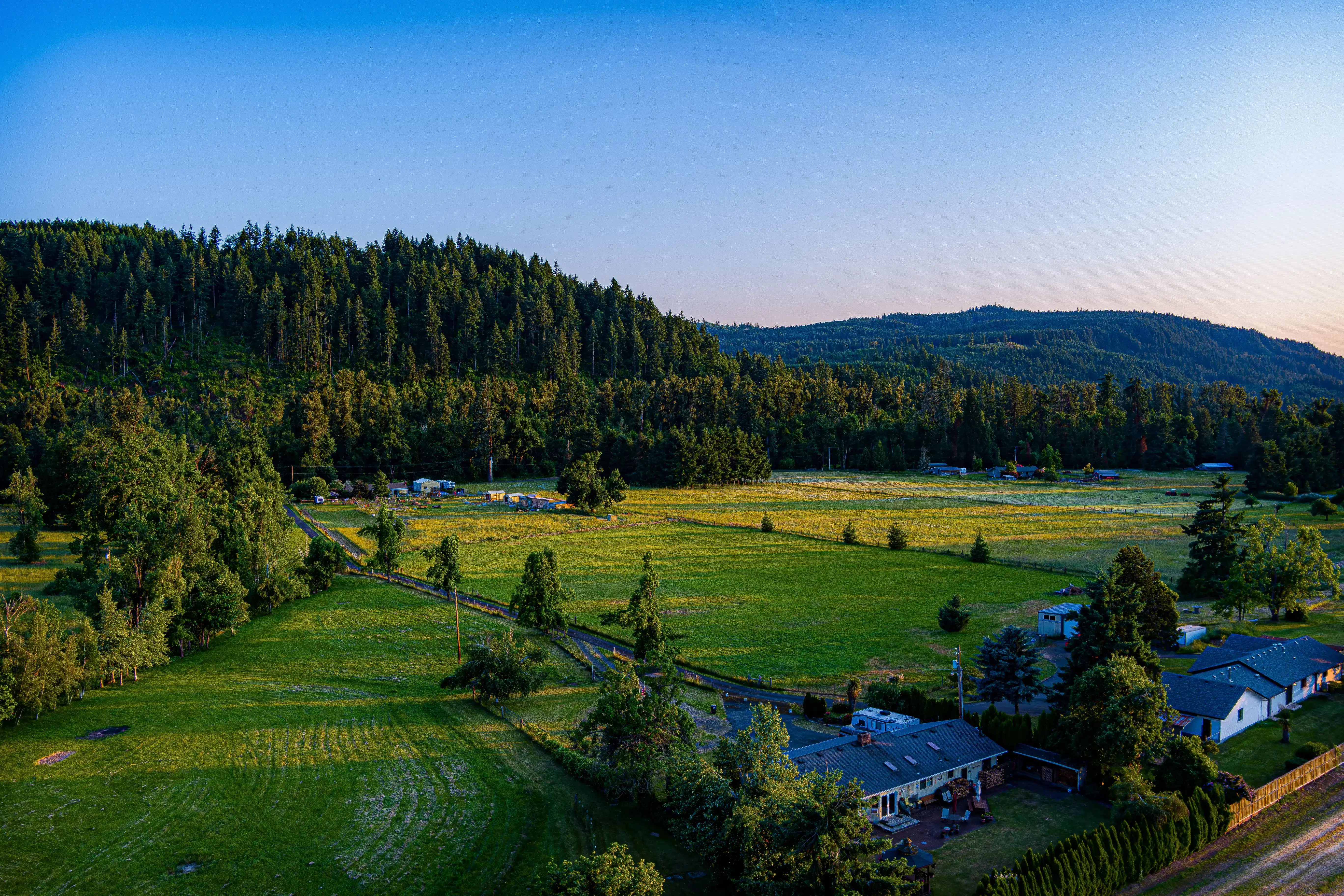
Living near Springfield's parks and trail systems genuinely influences what a home is worth over time — and how fast it moves. Homes in Thurston, where residents enjoy easy access to open space and the Middle Fork path connections, tend to attract strong buyer interest and often go under contract within days of listing. The same holds true in Hayden Bridge, where proximity to the Willamette River and nearby trail corridors makes well-priced properties disappear quickly. Even in Glenwood, ongoing development and improved park access are drawing buyers who want walkable outdoor amenities without stretching too far. Most desirable homes in these areas are still findable under $500,000, though that window doesn't stay open long once a well-located property hits the market.
Before you start touring homes near your favorite trailhead, have an honest conversation with a lender first. Your real monthly payment includes not just principal and interest but also property taxes, homeowner's insurance, and any HOA dues — and that full number can look quite different from what an online calculator shows. I always encourage buyers to think about a comfortable payment rather than chasing maximum approval, because those aren't the same thing.
| Destination | Distance from Springfield | Highlights |
|---|---|---|
| Mount Pisgah Arboretum | 8 miles | 7 miles of trails, Willamette River access, wildflower meadows |
| McKenzie River Trail | 45 miles east | 26-mile scenic trail, hot springs, waterfalls |
| Waldo Lake | 75 miles east | One of the clearest lakes in North America, sailing, kayaking |
| Crater Lake National Park | 120 miles south | Iconic volcanic lake, rim trails, winter snowshoeing |
| Oakridge Mountain Biking | 40 miles southeast | World-class singletrack, hub town for long-distance riders |
| Salt Creek Falls | 55 miles east | Oregon's second-highest waterfall, short hike from parking |
| Spencer Butte (Eugene) | 12 miles west | 2,000-foot summit, panoramic valley views |
| Willamette National Forest | 50+ miles east | Extensive backcountry, Three Sisters Wilderness access |
Local Expert Takeaway: The Middle Fork Path corridor is the most underrated buyer asset in Springfield's outdoor lineup. Homes within walking distance of either Dorris Ranch or Clearwater Park entry points have a long-term livability advantage that doesn't show up in price comparisons the way a good school rating does — but buyers who spend time on that path before making an offer tend to feel it. If you're choosing between two similarly priced homes, proximity to the Middle Fork Path is worth factoring in the same way you'd factor in a garage or a renovated kitchen.
Springfield punches significantly above its weight for a city its size. The Willamalane District manages close to 1,500 acres of parks and natural areas, the Middle Fork Path provides a paved river corridor connecting major parks, and Thurston Hills offers mountain biking and hiking terrain that most suburbs can't match at any price point.
What is the best park in Springfield, Oregon?
That depends on what you're after. Thurston Hills Natural Area draws serious hikers and mountain bikers with 12-plus miles of trails and 665 acres of forested terrain. Dorris Ranch appeals to families and history-minded walkers. Splash! at Lively Park wins for families with young children, especially in the rainy months when outdoor options shrink.
Does Springfield have a community recreation center?
Yes — the Bob Keefer Center at 250 S. 32nd St. is a 96,000-square-foot facility with indoor courts, a climbing wall, fitness center, and youth programming. The Willamalane Adult Activity Center on W. C St. serves adults 50 and older with a separate set of programs, classes, and community spaces.
Explore the full Springfield series: Relocation Guide · Is Springfield Safe? · Cost of Living · Best Neighborhoods · Schools & Family Life · Youth Sports · Parks & Recreation · Retiring in Springfield · 1031 Exchange · First-Time Buyer · Down Payment Assistance · Moving from California