Eastern Oregon · Oregon
Parks & Recreation in Burns: Trails, Facilities & Outdoor Life (2026)
Burns isn't the kind of place where the outdoor infrastructure surprises you with polish — it surprises you with scale. The nearest wilderness area is a 187,000-acre national wildlife refuge teeming with over 300 bird species. The closest national forest trailhead sits at 5,000 feet in old-growth ponderosa pines. For a town of under 3,000 people, the volume of public land accessible within 30 to 45 minutes of downtown is genuinely staggering.
What shapes the parks and rec landscape here is geography and federal land management, not municipal investment. Harney County is one of the largest counties in the lower 48, and the majority of meaningful outdoor recreation happens on BLM, Forest Service, and U.S. Fish and Wildlife land rather than city-maintained parks. High Desert Park & Recreation District is the local operator coordinating community sports, swim lessons, and youth programs — but the heavy lifting outdoors is done by open range, rimrock, and migratory flyways.
This guide breaks down what Burns residents actually use: the city and county parks, the trails with verified access points, the community pool, and the regional destinations that make this corner of Eastern Oregon worth understanding before you decide where to plant roots.
| Park / Destination | Highlights | Best For |
|---|---|---|
| Theimer Park | 400 acres of pine/juniper, canyon terrain, creek, Boy Scout cabin | Hiking, group retreats, nature exploration |
| Craddock Park | Public use, limited development | Quiet outdoor time |
| Idlewild Campground (Malheur NF) | Ponderosa pines, picnic shelter, trailhead hub | Camping, hiking, winter snow park |
| Burns Nature Trail / Harney Wildlife Parkway | 3.1-mile flat out-and-back, wildlife viewing | Families, beginners, birdwatchers |
| Idlewild Loop Trail #317 | 2.8-mile loop, old-growth pines, CCC-era features | Hikers, mountain bikers, families with kids |
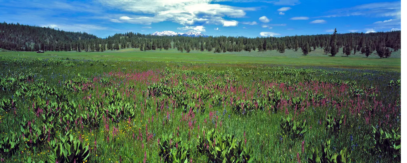
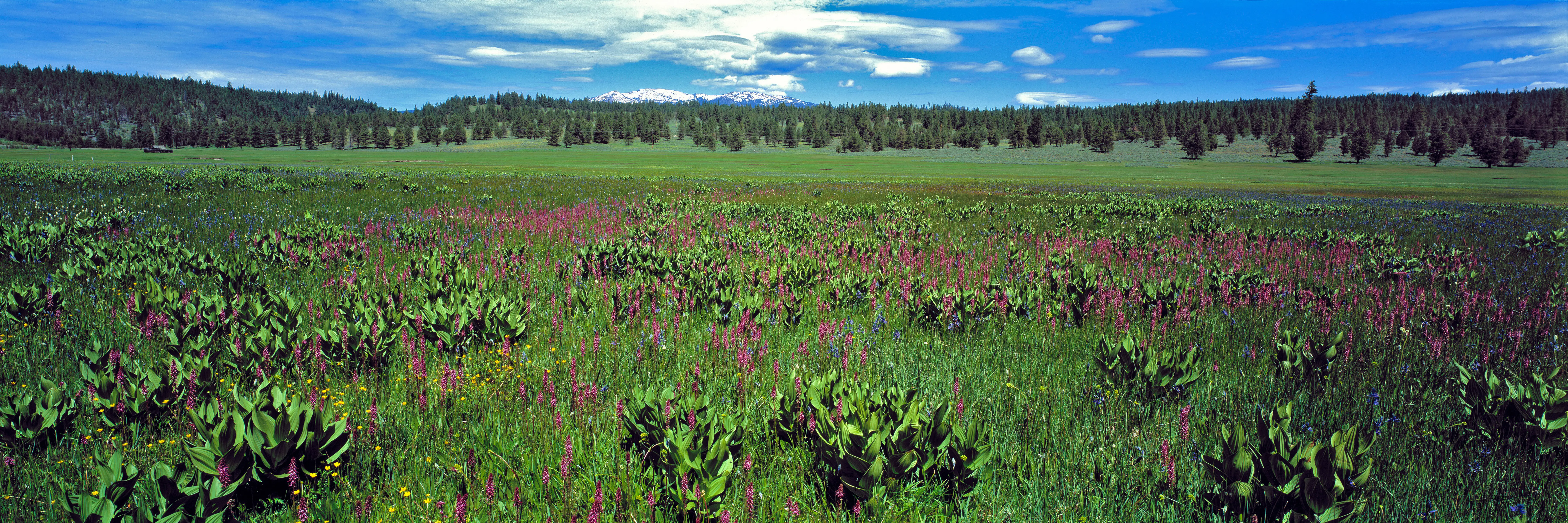
| Malheur National Wildlife Refuge | 187,757 acres, 300+ bird species, fishing, hunting | Birding, wildlife photography, hunting |
| Malheur National Forest Road Trails | 12+ mile combined routes, fir/hemlock forest | Distance hikers, mountain bikers |
Location: Approximately 12 miles north of Burns, access road off US Highway 395 at milepost 57
Theimer Park is Harney County's most scenic public park — 400 acres of ponderosa pine, juniper, and sagebrush draped across a canyon with a small creek running through the bottom. The county acquired it in 1936 for exactly one dollar, and it currently anchors the Boy Scout cabin program while remaining open to families, groups, and individuals. The canyon terrain and pine canopy make it feel dramatically different from the flat sage desert surrounding Burns, and it's the kind of place locals use for informal gatherings that never show up on any tourism map.
Best for: Families, group outings, scouts, anyone wanting shaded canyon hiking close to town
Location: Harney County; verify exact access with Harney County Parks at 450 North Buena Vista Avenue, Burns
Craddock Park is the county's second public park — quieter and less developed than Theimer, with limited infrastructure in place. It serves as a genuine open-space option rather than an amenity-rich destination, which suits the pace of life in Harney County just fine.
Best for: Solitude, open-space walks, low-key outdoor time
Location: Near Burns; trailhead accessible from town
At 3.1 miles out-and-back with just 13 feet of elevation gain, this is the most accessible trail in the immediate Burns area — flat, easy, and consistently low-traffic. Wildlife viewing is the draw, with the corridor designed to take advantage of the basin's bird and wildlife activity. Average completion time runs about 53 minutes, making it an easy after-work option for residents who don't want to drive north to the National Forest.
Best for: Families with young kids, beginners, birdwatchers, evening walks
Location: 14.6 miles north of Burns on US-395, then Forest Road 2820 to Idlewild Campground
This 2.8-mile loop is the most interesting trail close to Burns — weaving through old-growth ponderosa pines, past boulders, and along ancient ash-flow formations of welded tuff, with a CCC-era log fence and rock wall still standing along the route. Elevation gain of 173 feet makes it the most challenging local option, though that's a modest qualification. The area is also a designated winter snow park, meaning the same trailhead serves snowmobilers and cross-country skiers once the snow arrives in the Malheur National Forest.
Best for: Hikers, mountain bikers, families with school-age kids, winter recreation
Location: Highway 395 north of Burns, Malheur National Forest, elevation 5,000 feet
Idlewild functions as the primary outdoor recreation hub north of Burns — a full campground set in a large ponderosa pine stand with access to multiple trails, a reservable group day-use shelter for up to 75 people, picnic tables, campfire circle, grills, vault toilets, and drinking water. The Devine Summit Trail begins within the campground itself, and equestrian camping and horse trails are available within ten miles. Contact the Malheur National Forest at (541) 575-3131 for reservations.
Best for: Camping families, trail runners, group events, equestrians, winter recreation
The most substantial trail experience within range of Burns is the combined North National Forest Development Road 1450 and Forest Road 1651 route through the Malheur National Forest — a 12.1-mile one-way line through fir and hemlock forest that connects two forest road corridors with minimal crowds. The terrain is moderate throughout, and the route passes through genuinely less-visited forest than most Pacific Northwest hikers ever encounter. For mountain bikers, this is the kind of long, quiet singletrack-adjacent route that would draw trail pilgrimage crowds in Bend — here, you'll likely have it to yourself.
High Desert Park & Recreation District operates the community sports and aquatics programs for Burns and Harney County. The district runs a seasonal outdoor community pool located on the west side of Highway 20 directly north of Burns High School, reachable at (541) 573-2413. Summer programming includes swim lessons offered by skill level in 30-minute sessions, drop-in water aerobics, and the Hi-Desert Swim Team, which uses the pool for competitive training. Beyond the pool, the district coordinates youth and adult sports leagues, community events, and volunteer coaching and referee opportunities for residents who want to stay involved. It's a lean operation for a small-population county, but it covers the essentials.

Living near Burns's outdoor amenities genuinely shapes long-term value in ways buyers often underestimate. Homes within easy reach of the Steens Mountain Wilderness corridor and the quieter residential pockets near Harney County Library tend to hold their appeal because the lifestyle itself is the draw — people move here intentionally. That same intentionality means well-priced homes, typically under $300,000, don't sit long. Buyers who've done their homework on areas near Burns City Hall and the Desert Historic Theatre district sometimes find a property goes under contract before they've finished a second walkthrough. Access to trails, open space, and a genuine outdoor culture isn't a seasonal selling point here — it's permanent infrastructure that supports steady demand.
Before you start touring homes, sit down with a lender first. Your full monthly obligation includes property taxes, homeowner's insurance, and any applicable HOA dues stacked on top of the loan payment itself — and that complete picture looks different than the number a listing advertises. Getting pre-approved also tells you your comfortable budget, not just your maximum approval, so when the right place near the Steens Mountain corridor appears, you're ready to move
| Destination | Distance from Burns | Highlights |
|---|---|---|
| Malheur National Wildlife Refuge | ~30 miles south | 187,757 acres, 300+ bird species, fishing, hunting, hiking |
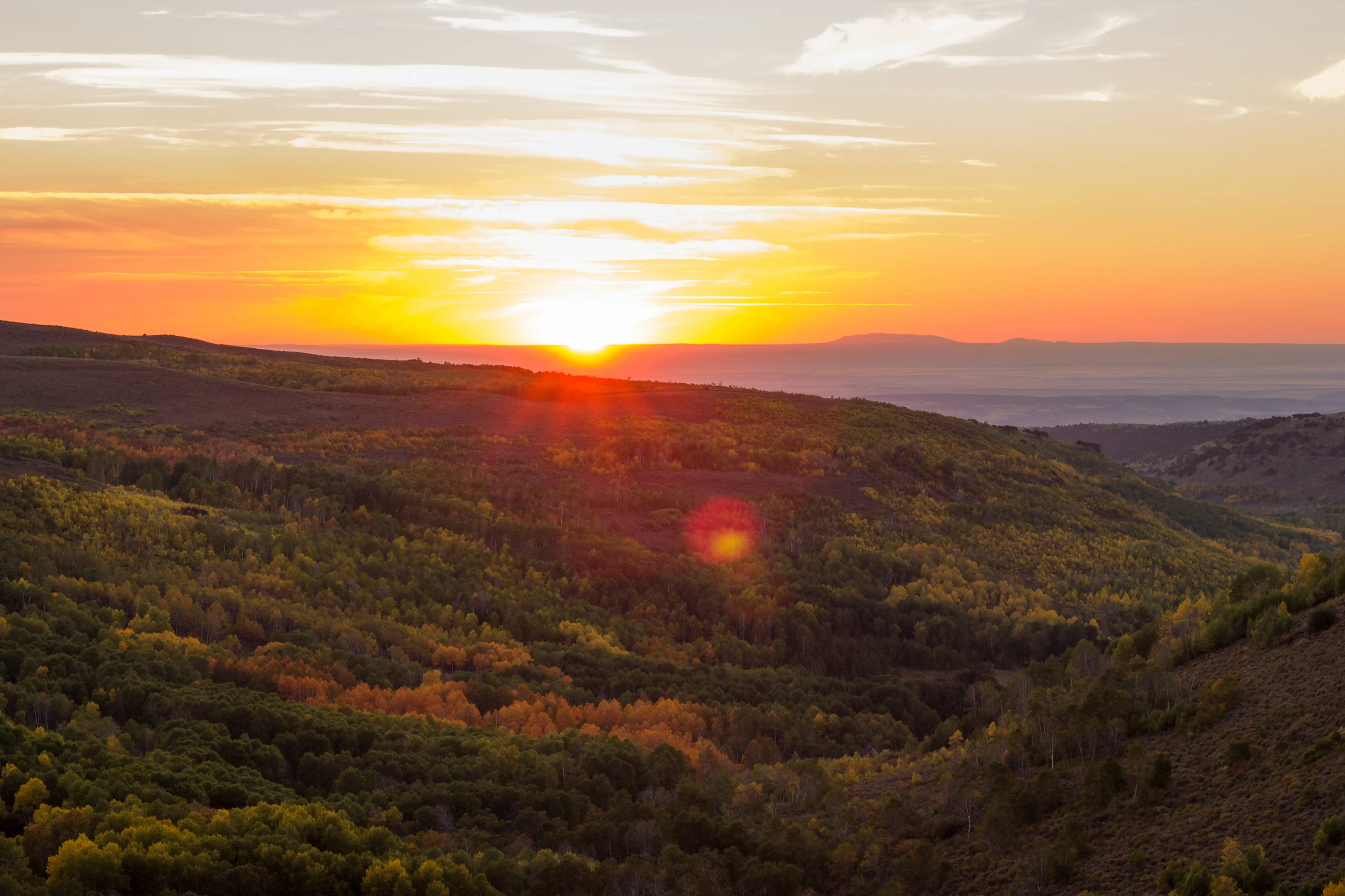
| Steens Mountain Wilderness | ~60 miles south | 9,773-ft summit, gorges, wild horses, backpacking |
| Diamond Craters Outstanding Natural Area | ~55 miles south | Volcanic geology, lava formations, solitude |
| Alvord Desert / Alvord Hot Springs | ~100 miles south | Playa camping, natural hot springs, stark desert landscapes |
| Ochoco National Forest | ~80 miles northwest | Scenic byway, fishing, dispersed camping |
| Frenchglen & Pete French Round Barn | ~60 miles south | Historic ranching, wildlife, Malheur refuge access |
| Bend / Deschutes River | ~130 miles west | Whitewater, trail network, Smith Rock proximity |

Local Expert Takeaway: The Malheur National Wildlife Refuge is consistently the most underrated reason to buy in Burns — and buyers focused on home prices often miss it entirely. The refuge draws serious birders and wildlife photographers from across the country, supports a strong local tourism economy, and gives residents a 187,000-acre backyard that can't be developed or taken away. If you're choosing between Burns and a comparably priced rural market in Eastern Oregon, the refuge access alone tips the scales.
What outdoor recreation is available in Burns, Oregon?
Burns offers a seasonal community pool, a flat wildlife trail ideal for families, and access to Idlewild Loop Trail in the Malheur National Forest — all within 20 minutes. Beyond town, the Malheur National Wildlife Refuge, Steens Mountain, and Diamond Craters provide world-class wilderness access within an hour's drive.
Does Burns have a community pool or recreation center?
Yes — High Desert Park & Recreation District operates a seasonal outdoor pool near Burns High School at (541) 573-2413. Programs include swim lessons by skill level, water aerobics, and the Hi-Desert Swim Team. The district also runs youth and adult sports leagues throughout the year.
How far is Burns from Steens Mountain and Malheur Refuge?
Malheur National Wildlife Refuge headquarters sits roughly 30 miles south of Burns via Highway 205. Steens Mountain is approximately 60 miles south, with the summit road accessible in summer months. Both are legitimate same-day destinations from Burns — no overnight stay required for most visits.
Explore the full Burns series: The Ultimate Burns Relocation Guide · Is Burns Safe? · Cost of Living in Burns · Best Neighborhoods in Burns · Burns Schools & Family Life · Burns Youth Sports · Burns Parks & Recreation · Retiring in Burns · 1031 Tax-Deferred Exchange in Burns · Burns First-Time Homebuyers Guide · Burns Down Payment Assistance Guide · Moving to Burns from California